Monster Storm Slam Boston With Strong Winds

Apr 24, Wednesday


Monster Storm Slam Boston With Strong WindsTop Stories

February 13, 2017 09:15
Monster Storm Slam Boston With Strong Winds

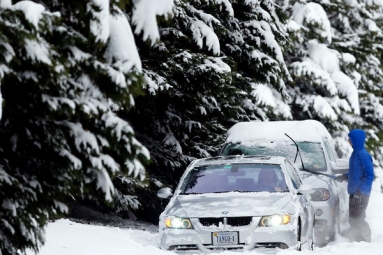
Another monster storm could drop a significant amount of snow for much of the area and it has caused many school closures, including in Boston.

Winter storm warnings have been posted for almost all the areas of Massachusetts that will last through Monday evening, along with high wind warnings for much of the eastern Massachusetts.

StormTeam 5 Chief Meteorologist Harvey Leonard said that, "this time the rain-snow line will play a crucial roll in the forecast around our area.” Boston Mayor Marty Walsh announced that Boston Public Schools will be closed on Monday due to the snow and a parking ban will be in effect starting at 8 p.m. on Sunday.

Gov. Charlie Baker called for an 11 a.m. start time for some of the state employees to give snow crews more time to cleanup.

Because the rain-snow line sinks, snow will be impacting the Boston area from Sunday evening to the Monday morning.

It will turn colder later overnight and much of the area will be covered under the snow.

Man Accused Of Kidnapping And Raping Woman

As the storm pulls into the Gulf of Maine, any mixed precipitation should flip over to the snow, which may come down heavily for a time prior to dawn on Monday. The morning commute will be heavily impacted by the snow.

Meteorologist Mike Wankum said that by 4:30 a.m. the second wave of the storm will bring snow along the coast with the possibility of blizzard conditions.

Winds will also impact much of the southern New England, beginning late on Sunday night, as the storm rapidly intensifies.

During the high tide cycle on Monday (around midday), winds will be strong from the north, resulting in the possibility for some coastal flooding along the north side of the Cape Cod, especially around Sandwich.

The storm will pull through the Gulf of Maine by the midday on Monday, bringing the snow to an end around the lunch hour.

Worcester County and southern New Hampshire are the areas that would receive the most snow, but the Boston area could see snow up to 10 inches.

StormTeam 5 is indicating Monday as the Impact Weather Day for the potentially larger storm later on Sunday through the Monday midday.

By Mrudula.

If you enjoyed this Post, Sign up for Newsletter

(And get daily dose of political, entertainment news straight to your inbox)

Rate This Article
(0 votes)
Monster Storm Slam Boston With Strong Winds

Monster Storm Slam Boston With Strong Winds

Apr 24, Wednesday


Monster Storm Slam Boston With Strong WindsTop Stories

February 13, 2017 09:15
Monster Storm Slam Boston With Strong Winds

Another monster storm could drop a significant amount of snow for much of the area and it has caused many school closures, including in Boston.

Winter storm warnings have been posted for almost all the areas of Massachusetts that will last through Monday evening, along with high wind warnings for much of the eastern Massachusetts.

StormTeam 5 Chief Meteorologist Harvey Leonard said that, "this time the rain-snow line will play a crucial roll in the forecast around our area.” Boston Mayor Marty Walsh announced that Boston Public Schools will be closed on Monday due to the snow and a parking ban will be in effect starting at 8 p.m. on Sunday.

Gov. Charlie Baker called for an 11 a.m. start time for some of the state employees to give snow crews more time to cleanup.

Because the rain-snow line sinks, snow will be impacting the Boston area from Sunday evening to the Monday morning.

It will turn colder later overnight and much of the area will be covered under the snow.

Man Accused Of Kidnapping And Raping Woman

As the storm pulls into the Gulf of Maine, any mixed precipitation should flip over to the snow, which may come down heavily for a time prior to dawn on Monday. The morning commute will be heavily impacted by the snow.

Meteorologist Mike Wankum said that by 4:30 a.m. the second wave of the storm will bring snow along the coast with the possibility of blizzard conditions.

Winds will also impact much of the southern New England, beginning late on Sunday night, as the storm rapidly intensifies.

During the high tide cycle on Monday (around midday), winds will be strong from the north, resulting in the possibility for some coastal flooding along the north side of the Cape Cod, especially around Sandwich.

The storm will pull through the Gulf of Maine by the midday on Monday, bringing the snow to an end around the lunch hour.

Worcester County and southern New Hampshire are the areas that would receive the most snow, but the Boston area could see snow up to 10 inches.

StormTeam 5 is indicating Monday as the Impact Weather Day for the potentially larger storm later on Sunday through the Monday midday.

By Mrudula.

If you enjoyed this Post, Sign up for Newsletter

(And get daily dose of political, entertainment news straight to your inbox)

Rate This Article
(0 votes)